


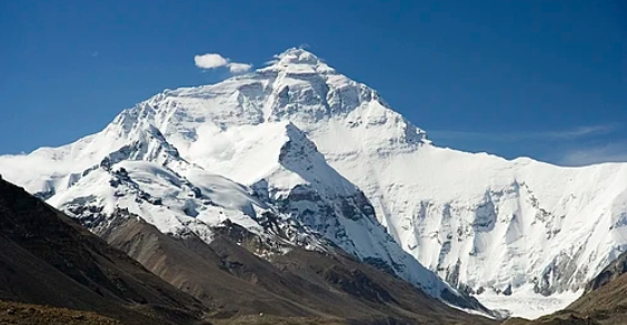
Introduction
The Everest Base Camp (EBC) Trek is one of the most iconic trekking experiences in the world. In modern trekking, using a GPX (GPS Exchange Format) file can help trekkers navigate trails, track progress, and plan their itinerary more efficiently.
This article provides a taxonomy-style overview of the Everest Base Camp trek GPX, including its benefits, how to use it, essential features, and practical tips for a safe and enjoyable journey.
What is a GPX File?
2.1 Definition
A GPX file is a digital GPS file that contains waypoints, routes, and tracks.
Trekkers use it on GPS devices or smartphone apps to follow a predefined path.
2.2 Key Features
Waypoints: Important stops like Namche Bazaar or Tengboche Monastery.
Routes: The trekking path from Lukla to Everest Base Camp.
Tracks: Detailed records of where trekkers have walked, including distance and altitude.
Why Use a GPX for EBC Trek?
3.1 Navigation
Ensures you stay on the correct trail.
Reduces the risk of getting lost in remote areas.
3.2 Altitude Awareness
GPX files often include elevation data, helping trekkers anticipate altitude changes.
3.3 Progress Tracking
Trekkers can track daily distance, speed, and estimated arrival times.
3.4 Safety
In emergencies, GPX files help rescuers know exact location coordinates.
3.5 Trip Planning
Enables pre-planning of daily trekking segments and rest stops.
Typical Everest Base Camp Trek GPX Route
Segment
Altitude (m)
Highlights
Kathmandu → Lukla
1,350 → 2,860
Scenic flight into Khumbu region
Lukla → Phakding
2,860 → 2,610
First trekking day, Dudh Koshi river views
Phakding → Namche Bazaar
2,610 → 3,440
Suspension bridges, Sherpa culture
Namche Bazaar → Tengboche
3,440 → 3,867
Monastery visit, Ama Dablam views
Tengboche → Dingboche
3,867 → 4,410
Imja Khola Valley, alpine scenery
Dingboche → Lobuche
4,410 → 4,940
Memorials for climbers, Khumbu Glacier
Lobuche → Gorak Shep → EBC
4,940 → 5,364
Base of Everest, glacier views
Kala Patthar
5,545
Best sunrise view of Everest
Return: Gorak Shep → Pheriche → Namche → Lukla
5,164 → 2,860
Descending route, reflection and relaxation
How to Use an EBC GPX File
5.1 Devices and Apps
GPS Devices: Garmin, Suunto, or other handheld GPS units.
Smartphone Apps: Maps.me, Gaia GPS, ViewRanger, or AllTrails.
Features: Real-time location, track recording, and distance measurement.
5.2 Downloading GPX Files
Available from trekking blogs, official tour operators, and hiking communities.
Verify accuracy by checking waypoints and elevation data.
5.3 Uploading and Using GPX
Import the GPX file into your GPS device or app.
Familiarize yourself with the map before starting the trek.
Activate track recording to log your path.
Use waypoints to navigate daily stops and teahouses.
Benefits of Using GPX for Group Treks
6.1 Group Coordination
Ensures everyone stays on the same trail.
Allows group leaders to monitor pacing and breaks.
6.2 Shared Navigation
Each member can have the GPX file on their device.
Reduces reliance on a single guide for navigation.
6.3 Emergency Preparedness
GPX files provide exact coordinates for medical or rescue situations.
Can be shared with local authorities if necessary.
Altitude and GPX Tracking
7.1 Importance of Altitude Data
GPX tracks often include elevation profiles.
Helps in planning acclimatization stops at Namche Bazaar (3,440 m) and Dingboche (4,410 m).
7.2 Monitoring Progress
Daily altitude gain and distance can be calculated.
Useful to prevent altitude sickness by pacing properly.
Customizing Your GPX
8.1 Adding Waypoints
Mark teahouses, monasteries, viewpoints, or emergency shelters.
Example: Tengboche Monastery (3,867 m), Lobuche Memorial (4,940 m).
8.2 Route Planning
Adjust daily distances according to group fitness and acclimatization needs.
Include rest days at Namche Bazaar or Dingboche.
8.3 Sharing
GPX files can be shared with group members or guides.
Allows everyone to follow the same route and track progress.
Safety Tips While Using GPX
Carry a Power Bank: GPS devices and smartphones drain batteries quickly.
Offline Maps: Download GPX and map data offline; connectivity is limited in the Khumbu region.
Backup Navigation: Carry a physical map as a backup.
Familiarize with the Device: Practice using the app or GPS before starting the trek.
Check Accuracy: Compare GPX route with guide instructions to avoid deviations.
Combining GPX with Traditional Trekking Knowledge
Guides’ Knowledge: GPX files complement, but do not replace, local guides’ expertise.
Weather Conditions: High-altitude trails can change due to snow, landslides, or avalanches.
Cultural Interaction: GPX does not capture local culture; guides provide insights into Sherpa traditions, monasteries, and festivals.
Advantages of Using GPX on EBC Trek
Accurate navigation through remote trails.
Monitors distance, pace, and elevation gain.
Enhances group coordination and safety.
Useful for planning acclimatization and daily trekking segments.
Provides records for future trekking references or sharing experiences.
Conclusion
Using a GPX file for the Everest Base Camp Trek is an effective way to enhance safety, planning, and navigation. While traditional trekking relies heavily on guides and experience, modern GPS technology allows trekkers to track progress, monitor altitude, and stay on course with confidence.
A combination of accurate GPX files, group coordination, acclimatization planning, and guide expertise ensures a successful and memorable journey to the foot of the world’s highest peak. Whether trekking solo or in a group, leveraging GPX technology is a valuable tool for exploring the Himalayas safely and efficiently.
Comments